If you could only take one document with you when investigating a piece of land in Nigeria, it should be the survey plan. Not the receipt, not the agreement, not even the Certificate of Occupancy. The survey plan is the only paper that answers the most basic question in the whole transaction: exactly which piece of earth are we talking about? Everything else in your file describes, argues about or gives permission over a piece of land. Only the survey plan actually points at it.
Every other document depends on that answer. A deed of assignment that does not attach a survey plan transfers something nobody can point at. A certificate that quotes a survey reference is only as good as the survey it quotes. And the crucial verification step of a Nigerian land purchase, in which the government tells you whether the land is free or under acquisition, is done entirely by taking the coordinates from a survey plan and placing them on the state’s official map.
Most buyers, though, treat the survey plan as a picture. They glance at it, admire the neatness, note that it looks official, and hand it back. Inside that drawing are the numbers that would have told them whether the plot is where they think it is, whether it is the size they were promised, whether it has been lodged with the government, and whether the plan itself was even prepared by a person entitled to prepare it. This guide teaches you to read it. For the wider process, see our complete guide to buying land in Nigeria.
What a survey plan is, and who may make one
A survey plan is a scale drawing of a parcel of land, produced by a licensed surveyor after physically measuring the land, showing the parcel’s exact position, shape, size and boundaries relative to a national reference system.
The key phrase is licensed surveyor. Surveying in Nigeria is a regulated profession, and only a registered surveyor may sign and seal a survey plan. A drawing produced by an unlicensed person, however professional it looks, has no standing. Ask for the surveyor’s name and registration, and be prepared to check it.
The parts of a survey plan, one by one
Open the plan flat on a table and work through these.
The title block
Usually at the bottom or in a corner. It states what the plan is, whose land it is, where it is, and who made it. Look for:
- The name of the person or company the survey was prepared for. Does it match the seller?
- The location: village or area, local government area, state.
- The date the survey was carried out.
- The plan number, a unique reference for that drawing.
- The surveyor’s name, signature, seal and registration.
The beacon numbers
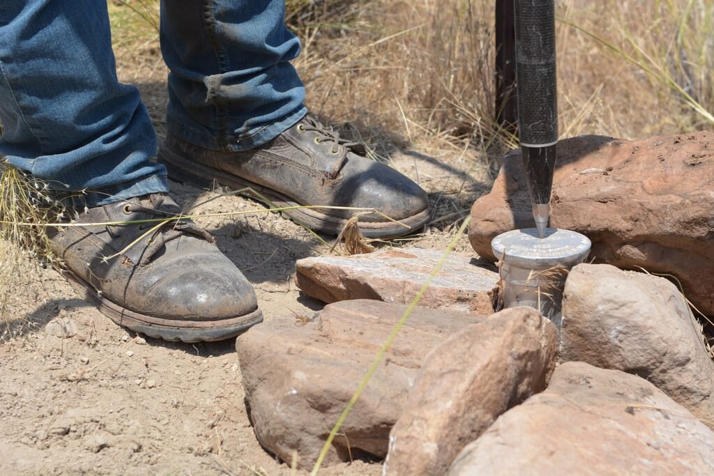
Beacons are the physical concrete pillars planted at the corners of the parcel, and each carries a stamped number. Those numbers appear on the plan at each corner.
This is your bridge between paper and ground. When you visit the land, you should be able to find those exact numbered pillars at those exact corners. If the plan shows four beacons and you find two, or you find pillars with different numbers, stop and get the surveyor to explain before any money moves.
The coordinates
Each corner carries coordinates, usually expressed as northings and eastings, tied to a national grid.
You do not need to understand the mathematics. You need to understand what they are for: these numbers are what the government uses to place your parcel on the state map during charting. They are also what allows a surveyor to walk onto empty bush and locate your exact corners years later, even if every beacon has been removed.
The bearings and distances
Along each boundary line you will see a bearing, which is a direction in degrees, and a distance in metres. Together they describe the shape of the parcel.
Practical use: add up the distances and compare the shape with what you were shown. A parcel described as “a plot” that turns out to be a long thin strip along a drainage channel is a different proposition from a square plot, even at identical area.
The area
Stated in square metres, and for larger parcels in hectares.
Do this arithmetic yourself. If you were told you were buying 600 square metres and the plan says 464 square metres, you have found a real discrepancy worth a conversation. Remember that “a plot” is not a fixed national unit. It varies by state and by estate. The number on the plan is the truth.
The adjoining parcels and features
A good plan shows what is next to your land: neighbouring parcels, roads, streams, drainage, power lines.
Look specifically for a road shown as proposed rather than existing, a stream or water channel touching the boundary, and any hatched area indicating a setback or reserve. These are the details that later become expensive.
The purpose statement
Many plans carry a line stating what the plan was produced for, such as a specific purpose or a named client. A plan produced for one purpose is not automatically valid for another. Ask your surveyor if you are unsure.
The lodgement or charting stamp
This matters enormously. A survey plan is normally lodged with the office of the Surveyor-General of the state, and a copy is retained by the government. Evidence of that lodgement is the difference between a plan the government knows about and a drawing that exists only in the seller’s file.
Ask directly: has this survey been lodged, and can I see evidence?
The three checks that actually protect you
Reading the plan is the beginning. These three actions are where the protection comes from.
Check one: charting at the government office
Take the plan, through your own lawyer or surveyor, to the state’s Surveyor-General’s office or land information office, and request a charting search. They will place your coordinates on the official map and tell you whether the land is free, under government acquisition, committed to a scheme, within a road setback or drainage reserve, or overlapping another registered parcel.
There is no substitute for this. It is the single most valuable spend in a Nigerian land purchase. See land registry search in Nigeria and government acquisition, setback and committed land.
Check two: a perimeter survey on the ground
Pay your own licensed surveyor, not the seller’s, to go to the land with the plan and locate the beacons.
This catches a specific and very common trick. A buyer is shown a lovely plot near the entrance road. The documents, however, describe a plot at the back of the estate, near the swamp. Everything on paper is genuine. It is simply not the land that was walked. A perimeter check ends this problem in a single afternoon.
Check three: compare across all your documents
The survey plan number on the deed, on the receipt, on the allocation letter and on the plan itself must all be the same number. The plot number likewise. Where a certificate exists, its survey reference must match too.
Inconsistent references are either sloppiness or something worse, and both are reasons to slow down.
Warning signs on a survey plan
- No surveyor’s seal, signature or registration details.
- No plan number, or a plan number that appears on somebody else’s document too.
- No coordinates, just a shape with dimensions.
- No evidence of lodgement with the Surveyor-General.
- A very old survey date with no recent re-establishment of beacons, on land that has since been developed all around.
- Beacon numbers on the plan that do not exist on the ground.
- An area that does not match what you were told, or a shape that does not match what you were shown.
- Only a photocopy, ever, with the original never produced.
- A plan that shows your parcel touching a river, drainage or high-tension line without anybody having mentioned it.
A short story about why this matters
Consider a buyer who pays for a plot in a developing estate. She is shown a flat, dry plot beside the estate road. She receives a survey plan, a receipt and an allocation letter. She does not chart the survey, and she does not take a surveyor to the land.
Three years later she is ready to build. Her builder brings a surveyor to set out the foundation. The surveyor locates the beacons on her plan and they are not beside the road. They are at the low end of the estate, where water collects. Worse, the charting she finally runs shows that part of her parcel falls within a drainage reserve.
Nothing she was given was forged. The plan was genuine, the receipt was genuine, the estate was real. She simply never checked which piece of earth her paper referred to. Two afternoons of work at the beginning would have saved her three years and a great deal of money.
Final thoughts
The survey plan is the least emotional document in a land transaction and the most factual. It does not make promises. It does not describe a vision of the estate in five years. It states, in numbers, where a specific piece of ground sits on the surface of the earth, how big it is, what shape it is and who measured it.
Use that. When an agent talks about growth and demand and a discount that ends on Friday, put the plan on the table and ask the boring questions instead. Who is the licensed surveyor and what is their registration? Has this been lodged with the Surveyor-General? What are the coordinates, and will you allow me to chart them before I pay? Can we walk to the beacons together this weekend? What is the exact area in square metres?
Those questions cost you nothing and they change everything. An honest seller answers them easily, and often with relief, because a well-informed buyer is a buyer who completes.
A dishonest one starts talking about how many other people are interested.